Project Overview
The Economic Master Plan to Develop the Surat Economic Region (SER) as a Growth Hub by 2047 outlines a strategic roadmap for transforming the region into a globally competitive economic powerhouse. This plan leverages advanced geospatial technologies—including satellite imagery, GIS mapping, and spatial analytics—to assess land use, infrastructure gaps, environmental constraints, and growth potential across the Surat Economic Region. This data-driven, spatially informed approach ensures that development aims to be balanced, resilient, and inclusive, aligning with long-term sustainability and economic goals.
Project Details
Organization:
World Resources Institute
Role:
Program Associate
Duration:
Dec 2023 - Jan 2024
Tools Used:
- QGIS
- Google Earth Engine
My Contributions:
- Conducted spatial analysis of land use and land cover (LULC) to assess urban expansion trends and identify potential growth corridors in the Surat region.
- Mapped infrastructure accessibility, including transport networks and public services, to support integrated planning for the growth hub.
- Analyzed environmental constraints such as flood-prone zones, vegetation cover, and water bodies to guide sustainable development.
- Supported the creation of data-driven maps and visualizations for stakeholder presentations and planning workshops.
Impact Summary:
This work contributed to the strategic planning of Surat’s Growth Hub Region by providing evidence-based spatial insights. The analysis supported balanced urban development, helped identify priority investment zones, and informed infrastructure and environmental planning aligned with long-term sustainability goals.
Selected Visuals
Showcase key maps, charts, or images that illustrate your project's process and results.
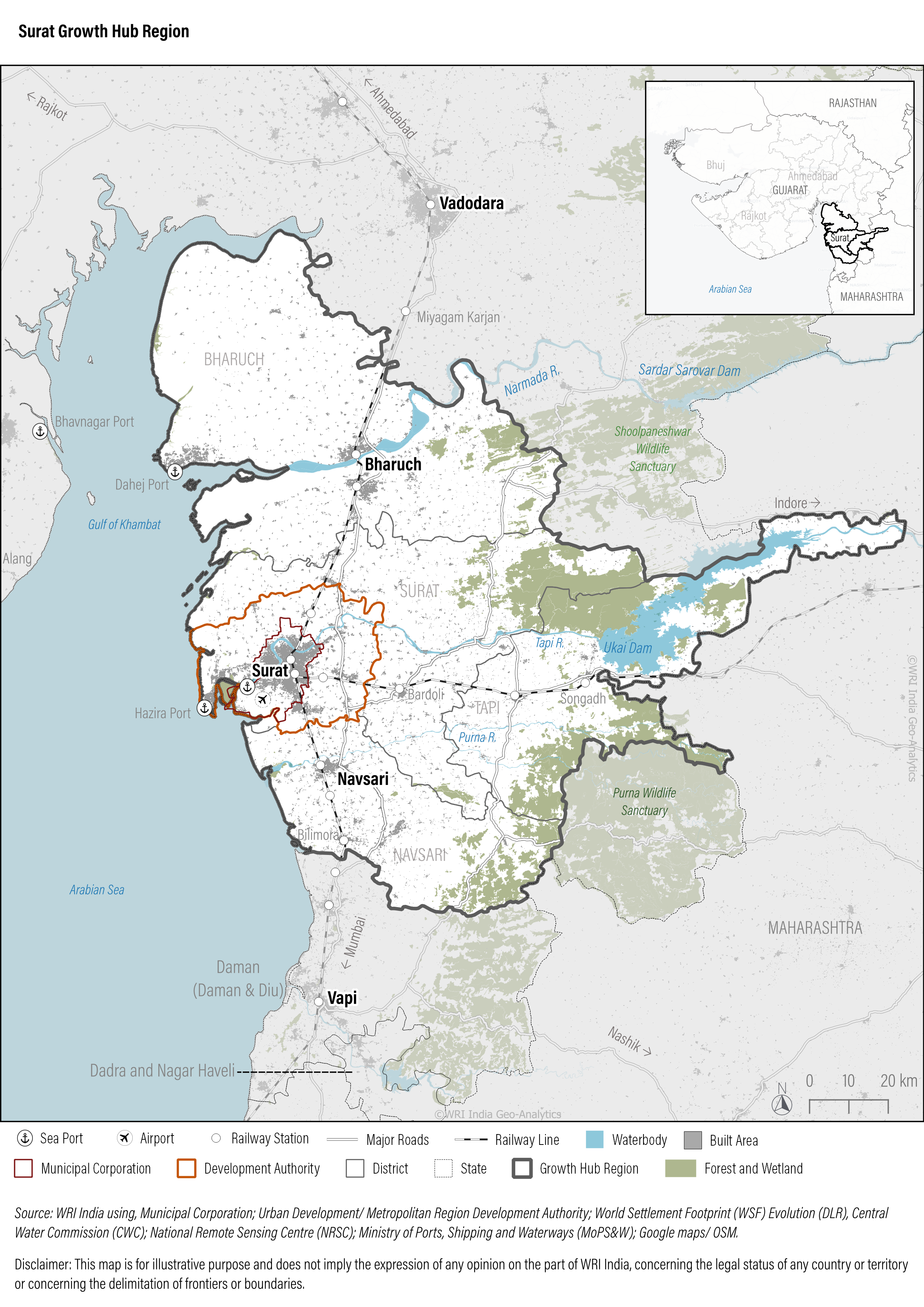
Growth hub region of Surat (Gujarat state), India using data from municipal corporations, remote sensing datasets such as World Settlement Footprint (WSF) and visualizations using QGIS