Project Overview
Mumbai’s vulnerability assessment highlights the city’s exposure to climate risks like extreme heat, flooding, and air pollution. Low-income settlements, often in dense, poorly ventilated areas, are most at risk. Urban heat islands intensify due to limited green cover and high built-up density, especially in central and eastern suburbs. The study emphasizes the need for targeted urban greening, heat-resilient infrastructure, and equitable public health interventions. Air pollution hotspots overlap with heat-prone zones, compounding health risks. The assessment guides climate action by identifying priority areas for adaptation, especially where heat stress and socio-economic vulnerability intersect
Project Details
Organization:
World Resources Institute
Role:
Program Associate
Duration:
Dec 2021 - Jan 2022
Tools Used:
- QGIS
- Google Earth Engine
My Contributions:
- Performed Urban Heat Island (UHI) analysis using Land Surface Temperature (LST) data to identify heat-prone zones across Mumbai.
- Analyzed the spatial relationship between LST and vegetation cover to support green infrastructure planning.
- Conducted accessibility analysis of fire stations using real-time traffic data to evaluate emergency response efficiency.
Impact Summary:
The analysis informed Mumbai’s Climate Action Plan by identifying vulnerable areas with high heat exposure and limited emergency access. The findings supported policy recommendations for urban greening and infrastructure planning.
Selected Visuals
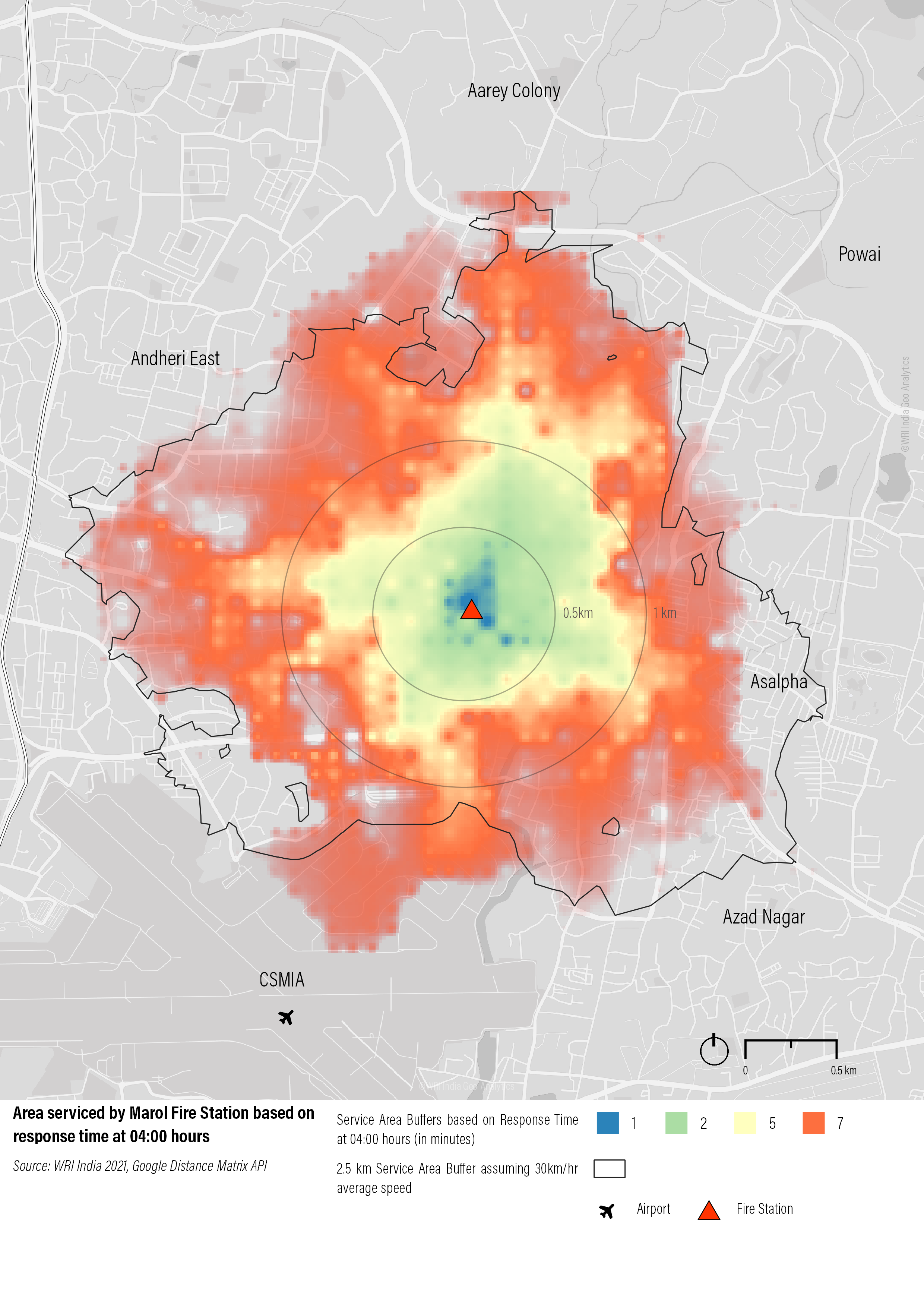
Accessibility map of Marol fire station based on traffic data from Google Distance Matrix API fetched using Python and visualization using ArcGIS Pro
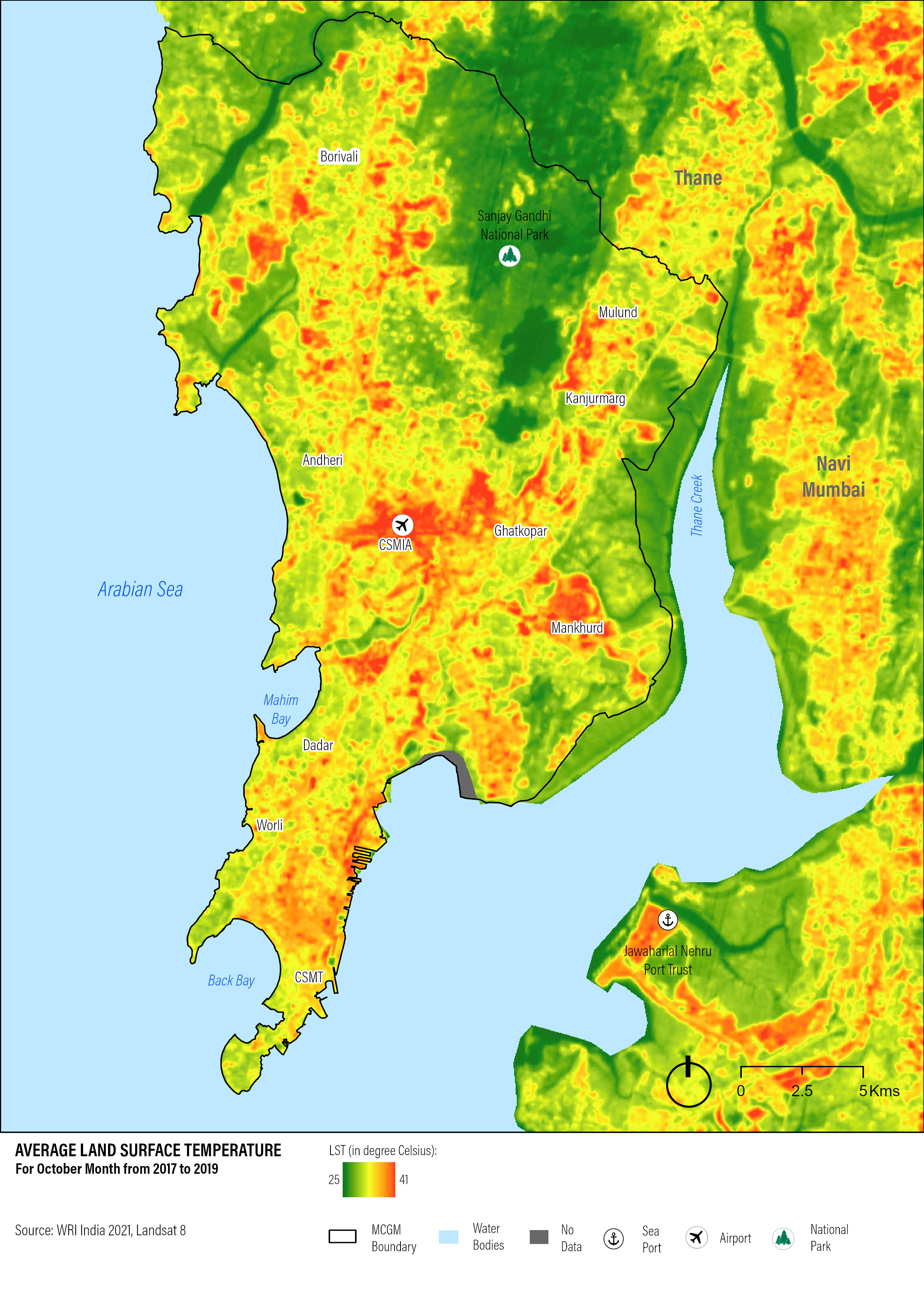
Urban Heat Island (UHI) map of Mumbai, India using processed Landsat 8 imagery in Google Earth Engine and visualization in ArcGIS Pro